Munra Point Scramble
Sunday, November 3, 2002
If you have been following our adventures,
you may remember that
from our bike ride in the Tanner
Creek watershed we saw Munra Point
and thought it would be cool to climb it. Scott did some research
and found
a map of the scramble trail, and on Saturday, August 24, Ellen
and Scott
made the first successful assault on the point. We took the very
best
adventure pictures ever on that occasion, and, like the fish that
got away,
they will only get better with time, because, sadly, Ellen left
the digital camera
on the hood of the car and it was lost for ever, along with all
the photos in it.
On Sunday, November 3, we went back
to Munra Point, this time with Emily and Jan.
Here are the photos with a cool 3D map and 3D aerial photo at
the end.

Scott took charge of the camera this
time. The lower part of the trail winds
through lovely woods between large Douglas Firs but trail is not
maintained.
Here's Ellen clamboring over a log across the trail.

Jan, Emi and Ellen pause for a photo at the point where Scott
and Ellen stopped
in August to put legs on their pants because of poison oak, which
was all over the trail.
Scott got a pretty bad case anyway that time, but now all the
leaves are gone and you
wouldn't even know there was poison oak here.

We stopped for lunch at a lookout point about halfway up. This
is looking west out
the Columbia Gorge. It was a very hazy day, so there's plenty
of atmospheric perspective,
but you can just make out Beacon Rock slightly to the right of
center.

Continuing on after lunch, we've got to get above these cliffs.

Across the Columbia we have a nice view of Table Mountain.
Jan and Scott climbed it earlier this year.

Emily and Jan, and a nice closeup of the basalt we're climbing
over...

...or, in some cases, sitting on.

At one point the trail goes straight up this short basalt face.
No challenge for rock climbin' Emily.

Emily on an outcropping.

We are very near the top now, but it's not in sight yet.

Ellen and Jan at the summit!

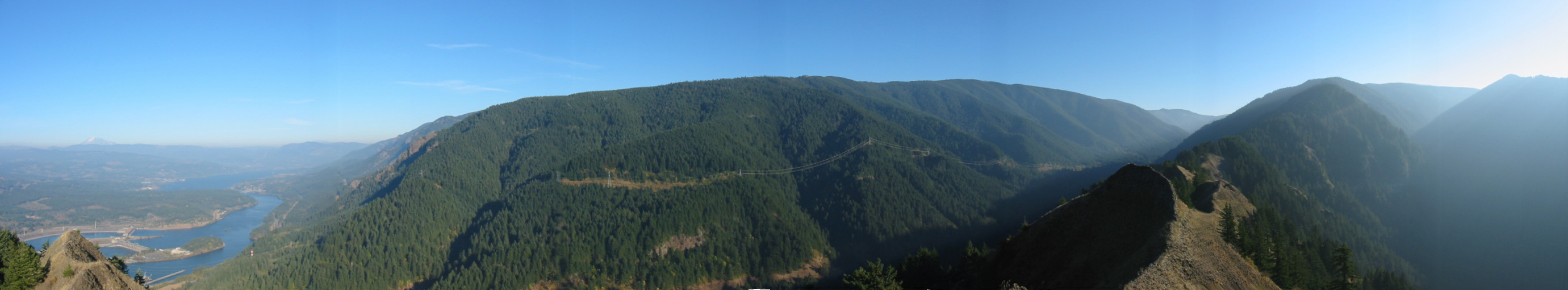
From the top, a panorama looking east and south. Click on the
image for the gigantic version.

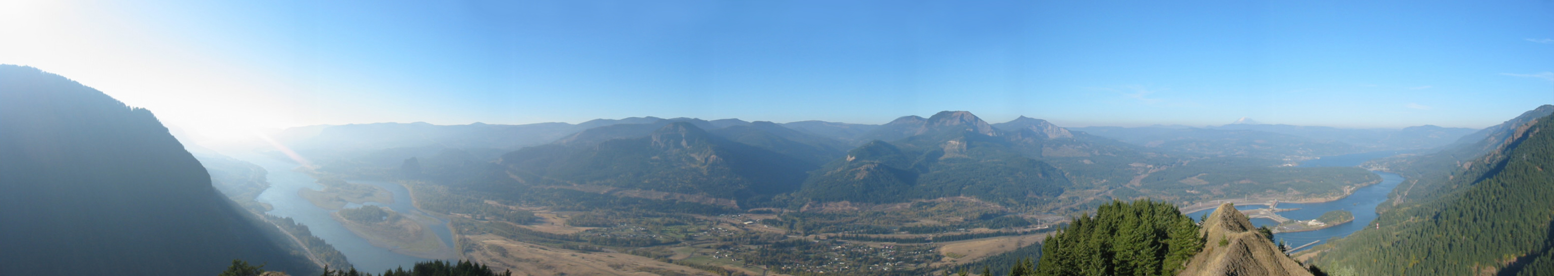
Panaroma looking west and north. Click on the image for the gigantic
version.

Looking east at the Bridge of the Gods.

From the top, looking over to Emily atop "the Dimetrodon."
It's a basalt outcropping shaped
roughly like the fin of that dinosaur. Scott climbed this in August
and when he dislodged a
rock it bounced and fell about 2000 feet before it finally stopped.

Emily, after conquering the Dimetrodon.

Ellen and Jan on the ridge to the north of the summit, with Mt.
Adams behind.

Here's Scott descending the rock wall.

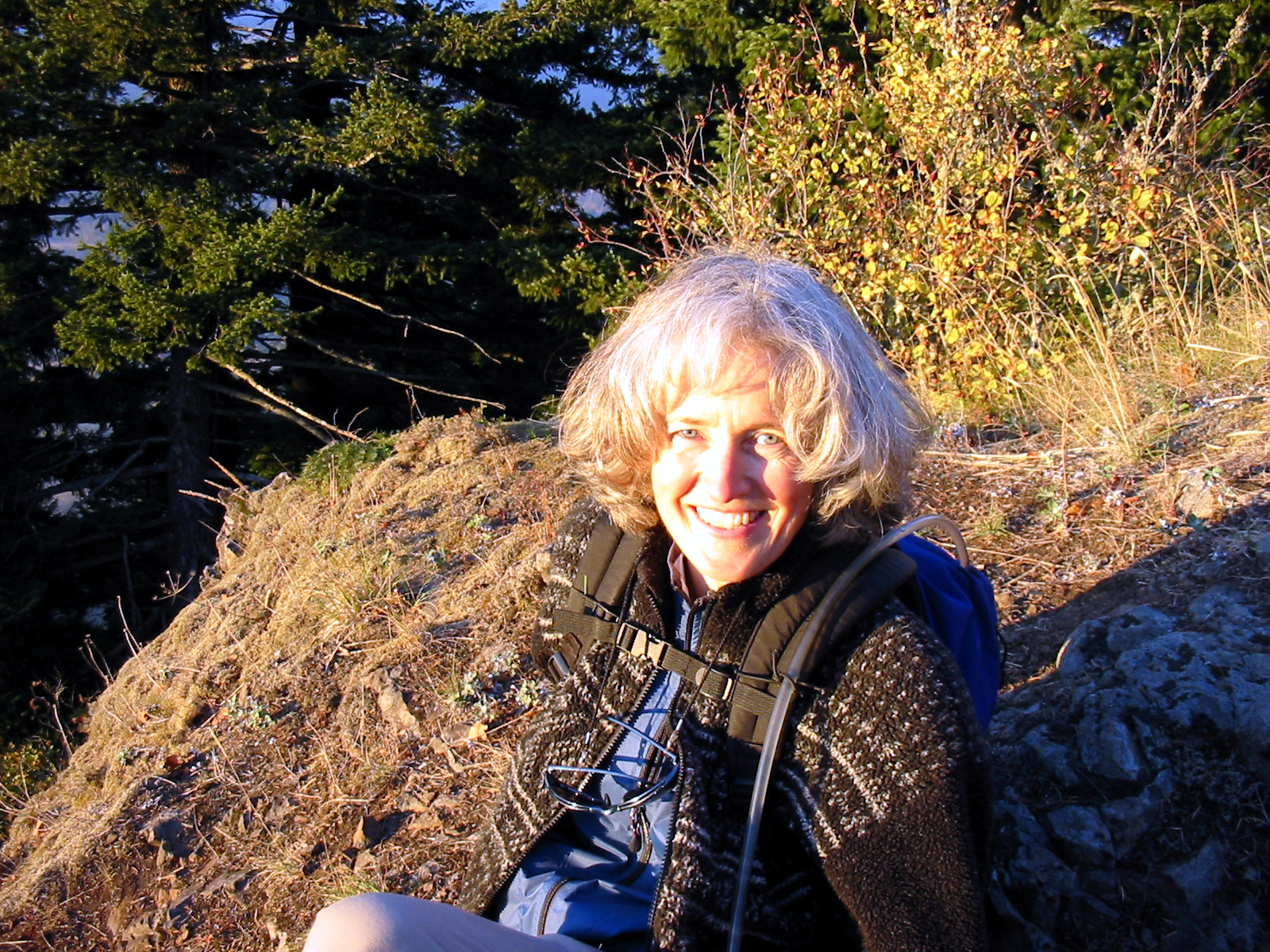
Jan, lit by the setting sun.

Sunset in the Gorge.

3D Map

3D Aerial photo. No, there wasn't an earthquake - the photo is
spliced
together from photos taken on different days.
The purple line is our track to Munra Point.

Adventures Index
info@ellenvanderslice.com